| ||
|---|---|---|
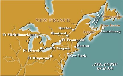
Louisbourg Regional Map |
Start Your Visit With ...Historical TimelinesChronological Eras Information Tables General Interest Maps Glossary History Quizzes |
|

Regional Maps
... 1953 US Atomic Energy Airborne Anomaly Location Maps(Fallout) 8 maps H62-52 1955 Maps Western United States by US Geological Survey 6 sheets includes Ogden, Torrington, Preston, Casper, Lander, Rock Springs blueprints US Geological Survey ...
http://wyoarchives.state.wy.us/databases/maps/regional.htm
Regional Maps
This page contains interactive Flash maps of six regions within the United States. Clicking on a tree icon will transport you to an individual site page that describes the general environment and the Metasequoias at that site. Note that these ...
http://www.skidmore.edu/~m_belsky/Regional.htm
1745 Capture of Louisbourg
Since Louisbourg was short of food that spring, hunger proved an effective spur to action. Using fishing vessels as transports and two privateers as escorts, 350 soldiers and sailors under Captain François Du Pont Duvivier moved on the attack ...
http://www.historynet.com/ah/bl-louisburg